How salt is actually distributed
Salt on the coast doesn't end at a fixed point. It weakens along a gradient: closer to the ocean, aerosols and salty winds are effective; further away, barriers, topography, humidity, soil, and irrigation errors become more important.
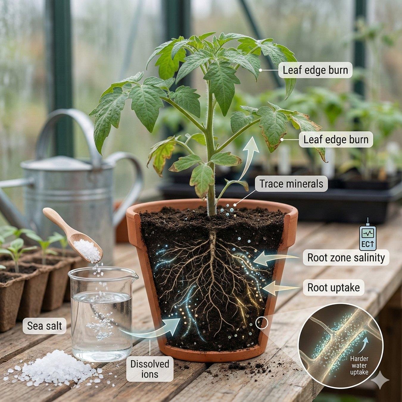
Gradient, not a boundary
Salt moves through the air, water and the surface
A design error is to assume that the salt "runs out" at 300 meters. In reality, it decreases gradually. The intensity is affected by distance from the ocean, wind direction, humidity, topography, the presence of barriers, and the quality of irrigation water.
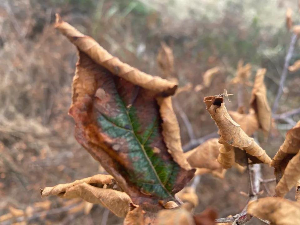
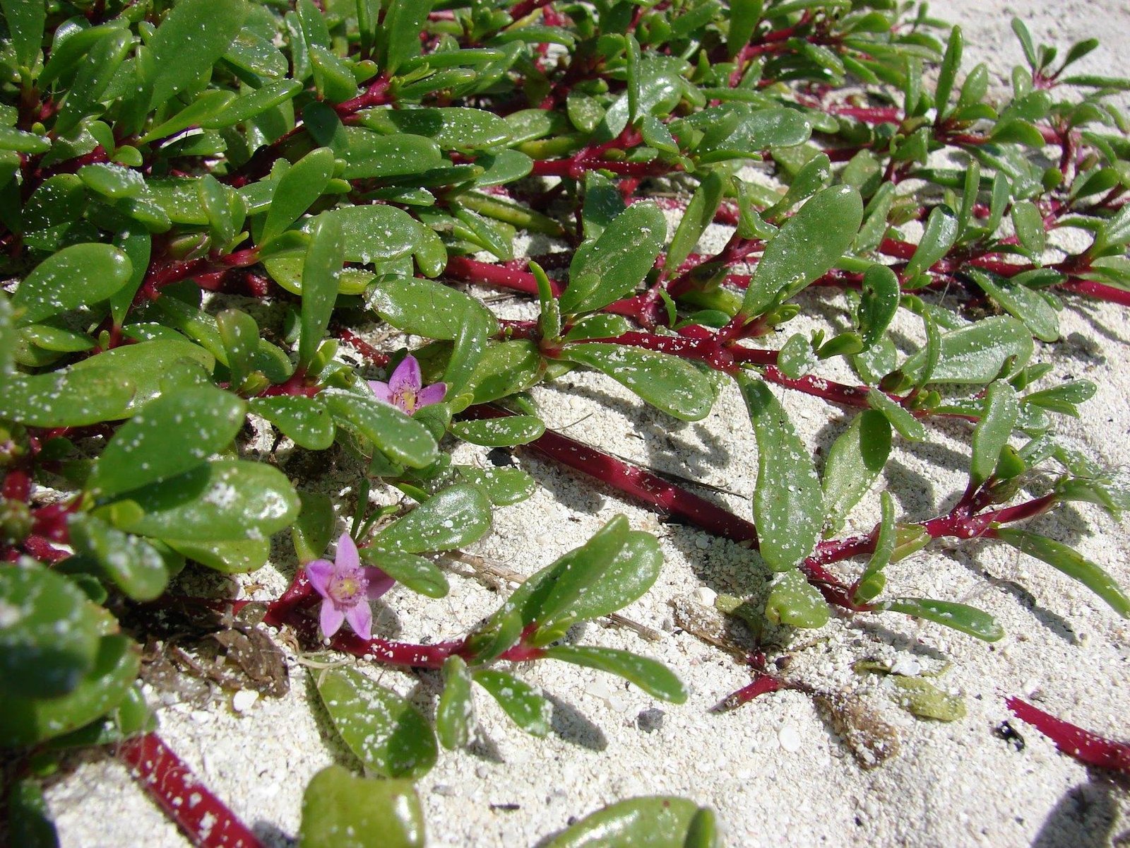
Marginal leaf burn indicates salt accumulation and water stress on the plant.
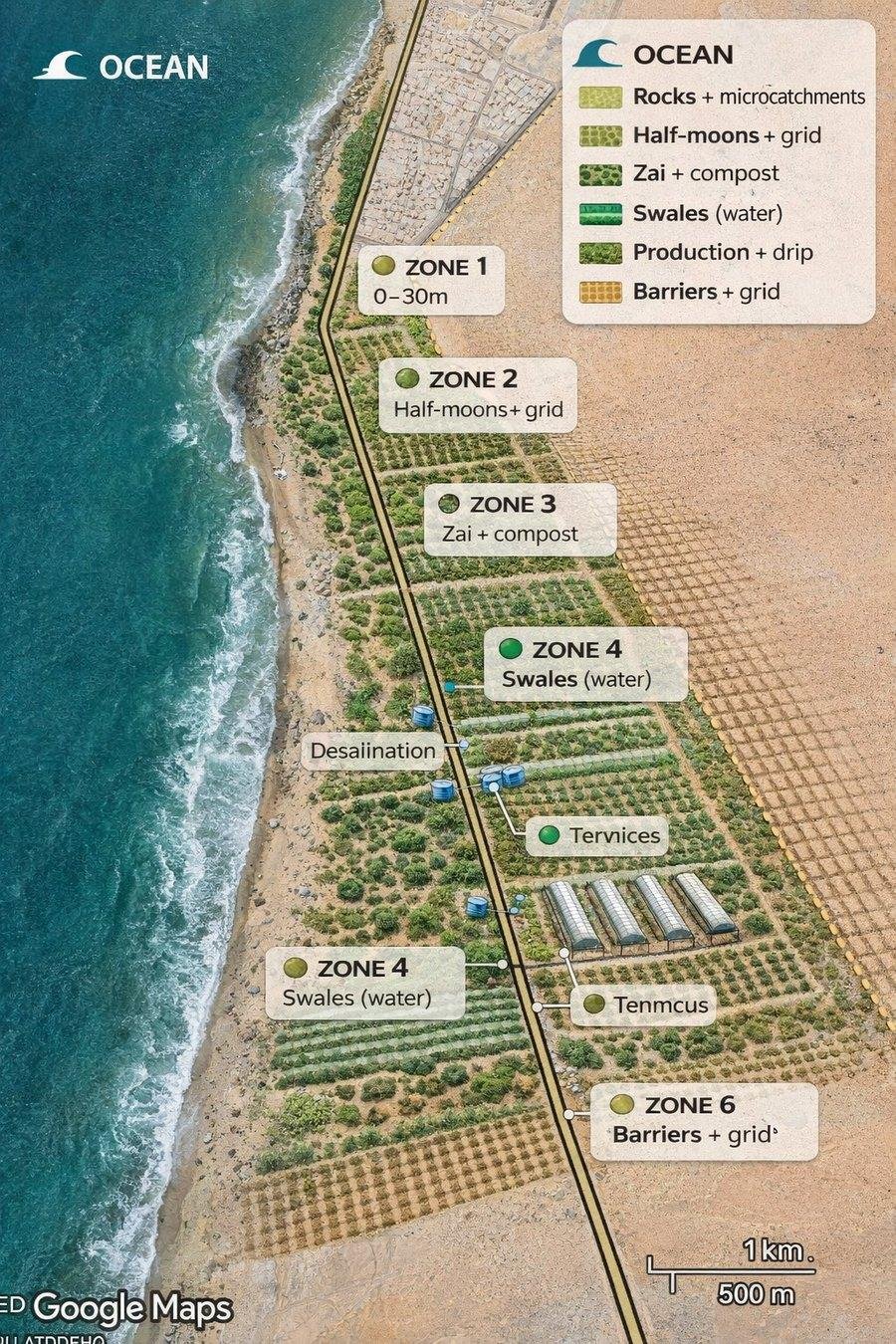
Coastal zoning shows how salt stress decreases from the ocean to the interior of the site.
Real gradation by distance
| Distance from the shore | The influence of salt | What's happening | Design solution |
|---|---|---|---|
| 0-30 m | extreme | only halophytes and barrier species survive | Atriplex, Tamarix, Salsola, sand fixation |
| 30-100 m | very strong | the salty wind still damages the leaves | resistant shrubs and the first line of trees |
| 100-300 m | average | You can build a system, but you need protection | second barrier, soil, drip irrigation |
| 300-800 m | weak | conditions are closer to normal, but depend on the wind | fruit trees in protected areas |
| 800 m+ | minimum | almost normal soil with normal water | a wider choice of crops, but salt monitoring is needed |
Three main routes of distribution
| Path | How it works | Why is this important? |
|---|---|---|
| Marine aerosol | The wind carries salty microdroplets; the stronger the wind, the further they fly | the first line of leaves bears the brunt |
| Fog and humidity | moisture can be beneficial, but it also brings salts | fog helps the project only in conjunction with salt-tolerant species |
| Soil and evaporation | salt water rises, water evaporates, salt remains | a salt crust can appear even inside the area |
Why does the barrier change distances?
If the area is exposed, salt aerosol can maintain a strong influence even over hundreds of meters. If there is a filtering barrier of shrubs and trees, the salt concentration drops sharply: the downwind zone receives less aerosol, the wind is weaker, and evaporation is lower.
What's important isn't a solid wall, but a filter belt. A wall that's too dense creates turbulence and flow rebound, while a living strip with moderate permeability dampens the wind more gently.
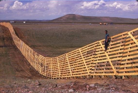
The filter barrier reduces wind speed and the transfer of salt aerosol.
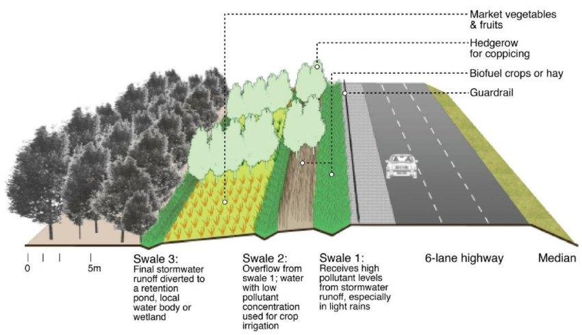
Swale ditches and microrelief retain water to prevent salt from concentrating near the surface.
Fruit crops are placed behind a salt-resistant barrier, and not in the direct aerosol impact zone.
How to calculate the distance from the safety belt
In practical design, it's more convenient to calculate not only from the ocean but also from the height of the first defensive line. Let's denote the height of the belt as H. The protective effect is usually expressed in multiples of H: the zone of strong protection begins at approximately 1.5-2H, the comfort zone at 3-6H, and the distant protected zone at 6-10H.
| Belt height | 1.5-2H | 3-6H | 6-10H |
|---|---|---|---|
| 3 m | 4.5-6 m | 9-18 m | 18-30 m |
| 4 m | 6-8 m | 12-24 m | 24-40 m |
| 5 m | 7.5-10 m | 15-30 m | 30-50 m |
| 6 m | 9-12 m | 18-36 m | 36-60 m |
What does this mean for fruit crops?
| Group | Recommended area | Examples |
|---|---|---|
| The most resistant fruit | 2-4H behind the first barrier with drip irrigation and closed soil | fig, pomegranate, jujube, prickly pear, date palm |
| Moderately sensitive | 3-6H in a more secure leeward area | olive, grape, mulberry, carob, almond |
| Sensitive | 5-8H, and for the most delicate ones 8-10H plus a second screen | citrus, mango, guava, papaya, avocado |
Landmark from the coastline
Without a precise site, this is not a universal norm, but a starting design logic for the harsh Atlantic coast: the closer to the ocean, the more important salt aerosol, turbulence, and direct sea winds become.
| Zone from the coastline | What to post |
|---|---|
| 0-30 m | only salt-tolerant shrubs and barrier species |
| 30-80 m | Tamarix, Casuarina, Atriplex, Salvadora, protective rows |
| 80-150 m | fig, pomegranate, jujube, prickly pear, date |
| 150-250 m | olive, grape, mulberry, carob |
| 250 m+ | citrus; next come mango and guava, given good soil and water |
Practical conclusion for DREVO
The salt doesn't run out, it weakens. Therefore, it's necessary to design not a single planting line, but a gradient of zones: the first line absorbs the salt impact, the second reduces wind, the third builds the soil, and then fruiting and production elements are placed.
The biggest mistake is to count only horizontal distances. More important are the barrier height, planting density, prevailing wind direction, and the salinity of the irrigation water.