Scheme on the project site
This article translates the general 1km model into a plan for placement on a specific line: the road becomes the axis of the project, the ocean side provides moisture and wind, and the inland side collects the system of zones, water, soil and planting.
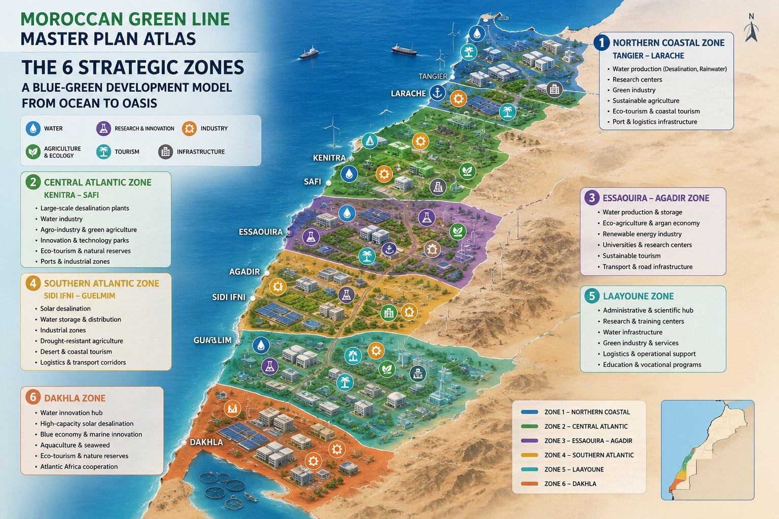
Road connection
The road is a convenient axis for the pilot
The coastal road can serve as the project's working line: on one side is ocean air, moisture, and salt aerosol, while on the other side is a system of zones, terrain, water, greenhouses, and protective barriers.
Placement of zones on the site
| Zone | Approximate position | What is posted |
|---|---|---|
| Zone 1 | 0-30 m from the ocean side | stones, micro-holes, protection from salt aerosol |
| Zone 2 | 30-100 m | half-wells, mesh, primary fixation of sand |
| Zone 3 | 100-300 m | zai-yamy, compost, mulch, soil formation |
| Zone 4 | 300-800 m | swales, trenches, reservoirs, water distribution |
| Zone 5 | 800-1500 m | production zone, trees, shrubs, drip irrigation |
| Zone 6 | further into the area | wind barriers, netting, desert wind protection |
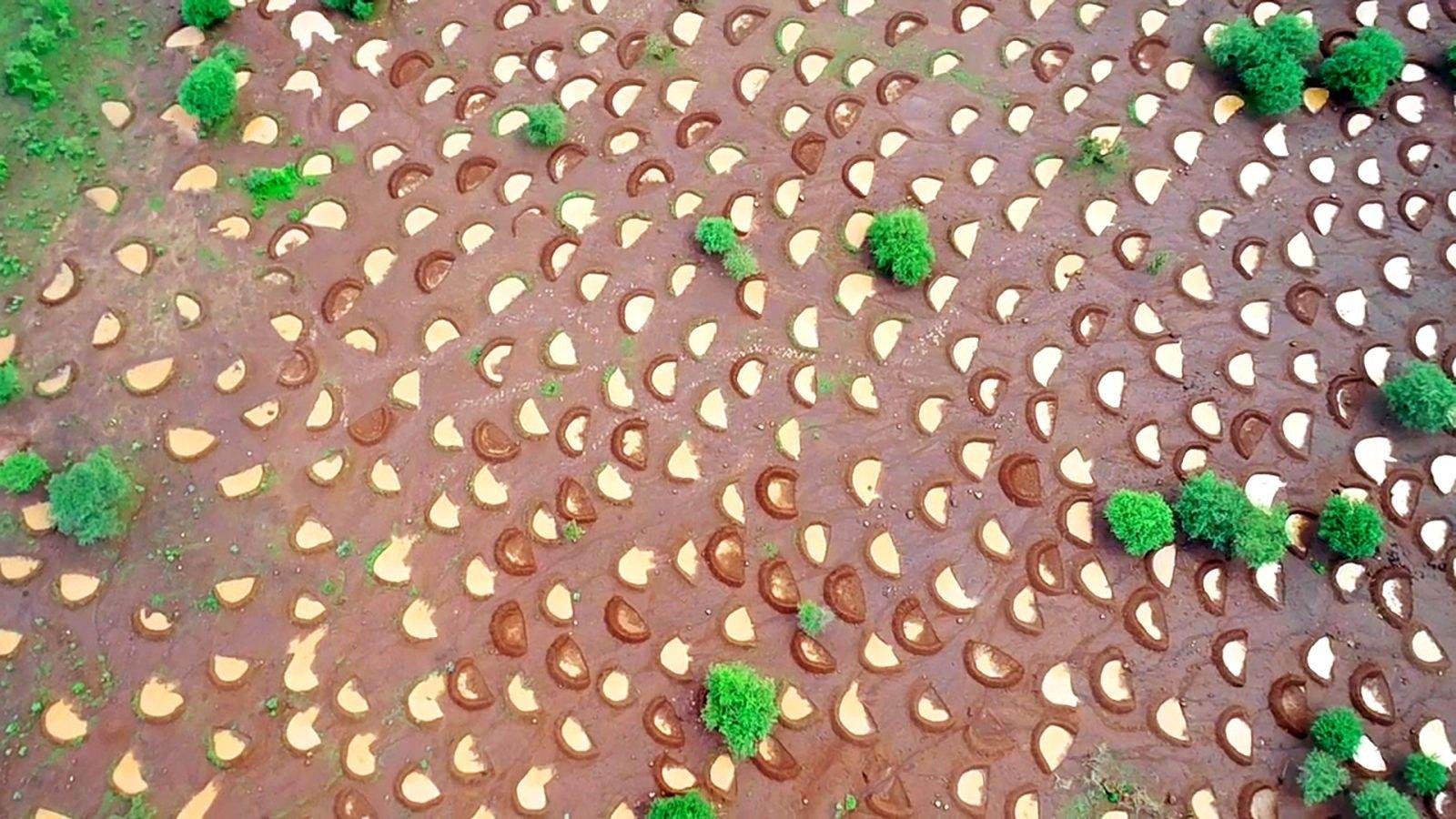
Half-holes are suitable for zone 2: they catch water and at the same time reduce sand carryover.
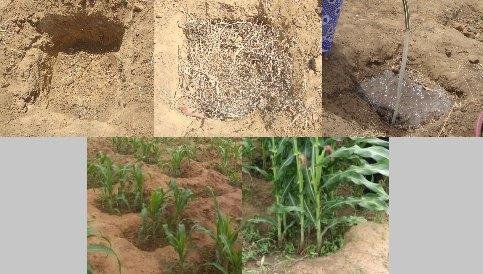
Zone 3 zai-pits combine planting, compost and localized moisture retention.
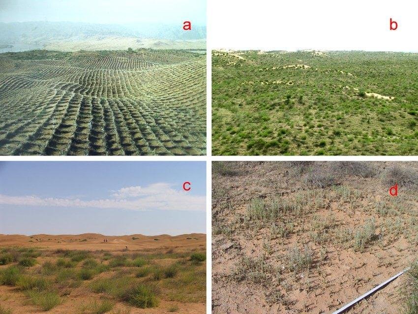
Mesh or cage fixation is needed where the sand is still mobile.
Wind direction
For a coastal desert, wind direction is a key factor. In a typical landscape, winds flow from the ocean to the interior. Therefore, barriers, trenches, and planting lines should be designed across the main flow, rather than randomly.
| Element | Orientation |
|---|---|
| Barriers | across the wind to reduce speed at the surface |
| Trenches | along the contour and across the direction of flow |
| Crescents | open part to the expected inflow of water |
| Landings | in protected lines, after relief and water preparation |
| Road | serves as the axis of service, water delivery and monitoring |
Module every 250 m
In practice, the section can be conveniently divided into repeatable modules of approximately 250 meters along the road. Such a module can be constructed, tested, and then repeated along the line without loss of control.
| Module component | Where to put | Why is it needed? |
|---|---|---|
| Refreshment | near the road, closer to zone 4 | easy access, maintenance and water supply to the tank |
| Tank | near the desalination and distribution line | water buffer for drip irrigation |
| Greenhouse | zone 4-5 | the seedlings are protected from ocean salt and the deep desert |
| Compost pits | zone 3 | soil and microbiology launch |
| Trenches | zone 4 | moisture collection and distribution |
| Barrier | zone 6 and in places zone 2 | reduction of wind, sand and evaporation |
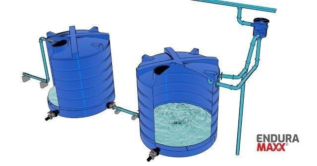
A roadside tank simplifies maintenance and water consumption control.
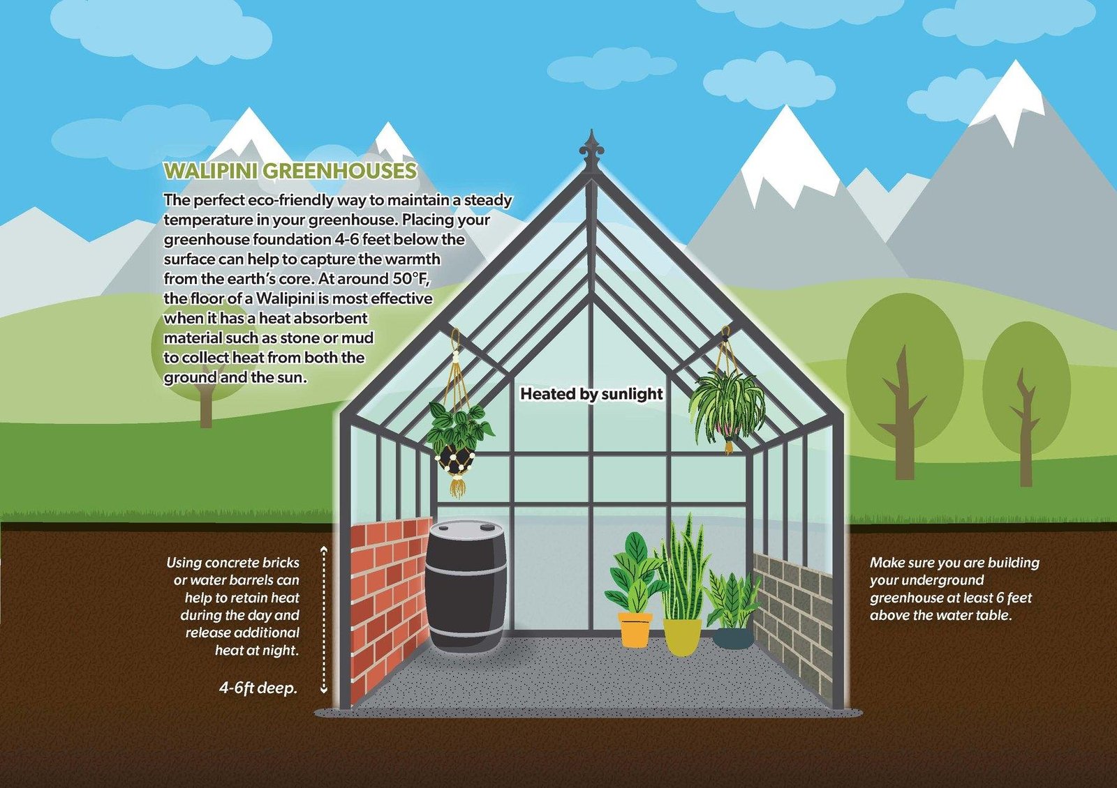
A greenhouse in zone 4-5 protects young plants and reduces seedling loss.
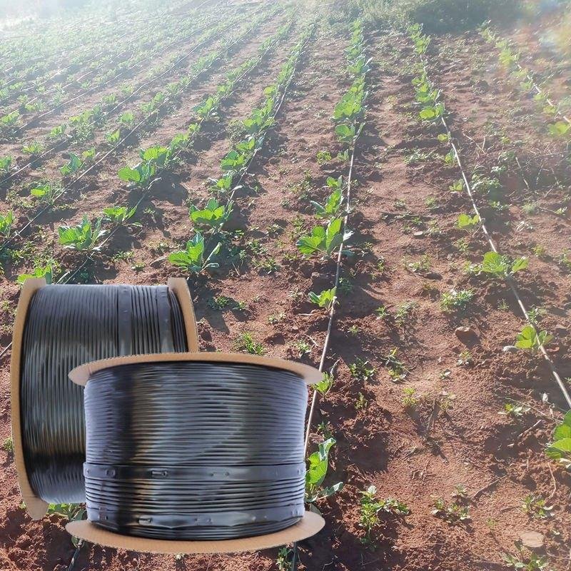
The drip network connects the reservoir, trenches and planting units.
Where to install desalination and greenhouses
Desalination plants shouldn't be located deep within the site; they must remain serviceable and connected to a road. Greenhouses are best located not near the ocean or in the deep desert, but in intermediate zones 4-5, where water is already available and salt stress is less severe.
What will be visible in 2-3 years
The result shouldn't look like a continuous forest. In a normal development phase, there will be stripes of greenery, patches of life, water lines, and isolated protected planting nodes. This is the correct intermediate result for a coastal desert.
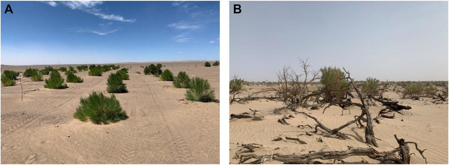
The first stable lines of greenery are formed where the relief and water work together.
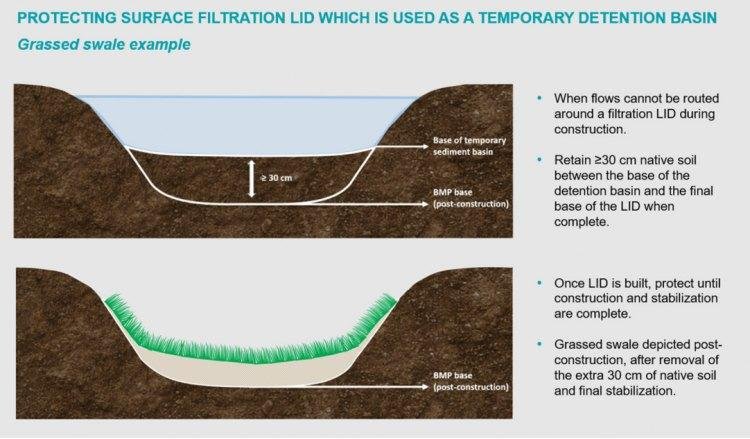
Trenches and swales retain water and guide the development of plantings.
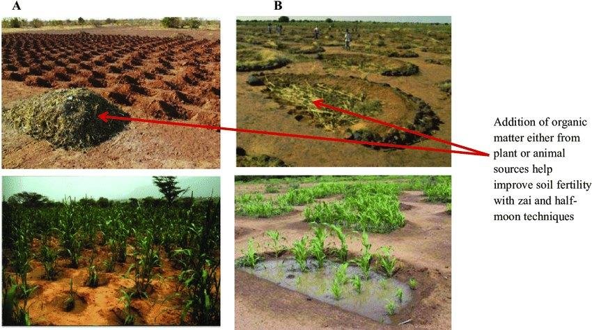
Repeated water nodes produce a grid of viable points rather than a solid forest.
Critical site conditions
| Factor | Conclusion for the project |
|---|---|
| Strong wind | Zones 2 and 6 are critical, without them the plants will lose moisture |
| Salt aerosol | the coastal zone should be protective, not productive |
| There is almost no soil | first the relief, organic matter and pits, then the trees |
| The road is nearby | This is an advantage for logistics, water, monitoring and scaling. |
| Long line | modularity allows for expansion without redesigning the entire system |
Conclusion
Such a site is suitable for a DREVO pilot if you start not with mass plantings, but with an engineered structure: wind protection, microrelief, water, soil, a nursery, and only then stable plantings.